Treas-yours T-railWhich way through Leicester did Richard III travel? Why is his such a famous reminder of how transport has changed in Leicester over many centuries? Walking, horse, rail, river, canal, roads and cycle routes are all in our Treas-your T-rail. You will be amazed at the extraordinary range of historical relics, both alive and disguised, still ‘hanging-in’ there awaiting your discovery and the wider world’s interest. Cultural and industrial heritage mingle amongst the skirts of a consumerist society.
We, the Wesley Hall Local History Day Centre Group invite you to discover these histories with our slideshow below. You can enjoy this in the comfort of your home and learn a lot as we have. Or, you can take a stroll to see how much history is packed into one mile of an ancient Roman town.
The google map shows our route, starting at Soar Lane, walking along the Grand Union Canal to Westbridge, over to Castle Gardens with King Richard III’s statue and then back around the old Roman town centre through to the Great Central Railway and back to Soar Lane.
|


Treas-yours T-rail Answers
1
This is an unusually empty street called Soar Lane. We are looking to the North East of the city and we can see Sanvey Gate at the end. This road runs along the northern line of the Roman wall that surrounded the city. The foundations of the Roman walls are beneath and beside the street.
2
The bridge we are standing on is over the Grand Union Canal – it leaves the River Soar here to go north and join the river again at the National Space Centre and Abbey Pumping Station to the west of Belgrave. It is called Soar Lane bridge, but it is the site of what was a very interesting contraption now housed at Snibston Discovery Park: http://www.movablebridges.org.uk/BridgePage.asp?BridgeNumber=1396
3
Going south, the canal has joined the river and we look towards Friars Mill and Castle Park.
4 & 5
Looking more closely you can see two little railway lines coming out of the ground.
The railway lines are left over from the Leicester to Swannington railway. It was the first railway to come to Leicester in 1832. There was a lifting bridge over the canal (see picture 2) so that the barges could go underneath the rail lines. The bridge would be lower so the trains could go across the canal and then lifted so that barges could pass underneath.
The famous Stephenson family was involved in building this railway, George provided capital and his son Robert was the appointed engineer. The locomotive Comet hauled the first train. It is very noteworthy that it was the third railway built in the world. It was an important railway because industry needed to bring coal from North West Leicestershire to Leicester, particularly Coalville. The coal was the crucial factor for the increasing and fast developing industries of Leicester. The track ran out of Leicester via Glenfield and a tunnel was required for them to be able to do this. Engineered by Robert Stephenson it is one of the first and longest tunnels in the country. They must have been so proud of it.
6
As we walk along heading towards Rally Park we find an interesting viewing platform. It is situated on the
site of the old Soar Lane Flour Mills.
7
We go up the steps to the viewpoint. To the North East East of the view we can see a big vista mostly
dominated by light industry. The line of the Roman walls goes through into the distant corner to the left of
the photo, behind the trees, to Sanvey Gate and Churchgate in the town.
8
Moving to face the east we can see the modern Highcross Shopping Centre and to the south east the spire is Leicester Cathedral, always known as the church of St Martins. This is in front of the burial ground of Richard III where he lay for 500 years, first in the Chapel of Grey Friars, which was demolished by Henry VIII. The Herrick family built a stately house on the site in 1612 and Richard III’s bones remained there with a stone pillar marking the burial. In 1914 land and gardens were sold to the local council and offices erected around the burial. In 1940 Greyfriars land becomes a council car park. The land was desecrated through the influences of war.
The Blue Boar Inn, known as the White Boar Inn by King Richard III, is directly in front of the Cathedral in this picture. The King decided to stay at the Inn rather than Leicester Castle because he believed his enemies would have expected him to stay there. Leicester was a Yorkist town and the White Boar Inn loyal to Richard. The Inn keeper did however, immediately change the name of the inn to the Blue Boar Inn as soon as Henry Tudor took the crown.
We also see in the foreground the site of the Great Central Railway which ran across the arches.
9
Further to the south we see another church spire. That is St Mary De Castro’s church and we can see the square tower of St Nicholas on the left of the picture. Evan’s weir traverses the River Soar and we can see some old equipment there.
10
Over to the south west side we see the old Friars Mill and the lovely River Soar at its junction with the Grand Union Canal. The weir separates the River Soar from the Grand Union Canal. This canal runs all the way from London to Langley Mill in Derbyshire, to the north west of Nottingham. http://www.ukwrs.co.uk/gecm/?p=110
11
Looking to the west the trees are part of Rally Park where the many sidings of the Swannington Railway came to a halt.
12
We see some wild and interesting plant life and on the other side of the park there are old Victorian terrace houses. This is the Tudor Road area of the city. Rally Park has recently been restored and is a well-used area with attractive paths and landscaping.
13
This is a cement processing plant. 100 years ago there were many canal wharves along this route and this area was Soar Lane Old Wharf. The viewing platform is situated on the old Soar Lane Flour Mills.
14
We have gone all the way around the view. There are so many treasures yet to discover. Our walk is already identifying them. This industrial area to the north lies atop the old canal wharves, one enchantingly named Pingle Wharf further to the left of the picture.
15
The lovely bridge over the River Soar is an original canal related construction. It has the same kind of stonework as the bridge over the canal. We wonder if these are the original cobbles. http://www.foxysislandwalks.co.uk/Leicester-Section/River-Soar-Bridge.jpg
16
This is the river bridge as we walk towards Rally Park. Look at these beautiful railings on the bridge.
17 – 18
Here are the railway ramparts for the bridge that crossed the river. They are again part of the railway from Leicester to Swannington. The rail tracks would have gone over the river using these beautifully constructed supports and carried on to the various wharfs and depot areas to pick up and drop off coal and goods for the surrounding industries. There were many coal merchants in the area as well as mills and engineering industries.
19
This is another view of the same bridge. Here is another one of our treasures. This stump at the end of the bridge is likely to have been used to stop the horse carriage wheels from bashing into the bridge structure. These look like the original cobbles around it.
20 & 21
The railway lines covered the whole of this area. Perhaps these cobbles are some reminder of all the railway sidings which were here long before Rally Park. We can see semi-circular patterns in the cobbles made of large rectangular arching slabs of granite they could be a reminder of an old turntable to turn the steam engines round to go back out of the city. Steam engines would be coming in and out all round here – items such as factory goods, coal, granite, slate, gypsum and wool.
Some folk history – Stephenson invented the steam whistle in Leicester after a drunken farmer and his cart full of butter and eggs sadly got run over by a steam train in 1833 near Thornton. Imagine the first of ALL steam whistles for trains was invented, used and heard in Leicester! Now trains ‘whistle’ throughout the whole world! http://www.leicesterchronicler.com/whistle.htm
22
This is a helpful walking or cycling map but sadly it does not tell us anything about the history of Rally Park. The word ‘rally’ derives from a local slang word for the railway.
23
We are now on the west of the river and are looking across to the weir. We can still see the Cathedral spire and Friars Mill on the other side of the river bank. To the right of us we see the newly built city apartments. Much more about the area’s history was discovered by the University of Leicester’s Archeological Department before these were constructed. Their digs revealed a formidable roman structure, up to 3m wide, amongst the widest of town walls in Roman Britain. http://www.le.ac.uk/ulas/regeneration/roman/westbridge_wharf.html
24
Peaking through the fence we can see an area that used to be railway sidings. Now it is used by Kirby and West as a milk depot. They still use the area as a major distribution point of milk for the city of Leicester. This is part of the light industry still to be found in this area and relates again to transport.
25
Here we have an old mechanical Victorian cast iron contraption. There are two; another is on the other side of the weir. They may have been something to do with flood control and water levels for the Grand Union Canal which branches off here to the North West. It is an historical artifact, which asks us to find out more about what kind of treasure is this.
26
Forget the rubbish – look at the construction!
27
This is a recent picture of Friars Mill before it was semi destroyed by a tragic fire.
28
Friars Mill frontage after it was damaged by the fire and we are invited to walk down the delightful canal and river path.
29
The canal was dug out in 1794. It enabled the mooring of deeper barges alongside Friars Mill. How terrible only to have a heap of rubble left in place of so much of the building
The demolition has allowed us to see the cathedral again. It really stands out. It is behind the old Wyggeston Hospital buildings at Applegate.
30
They are still working on removing the demolition rubbish with their big JCBs. Over 100 years ago it would have all been removed by barges but now we have a big road network and it will all be removed by trucks and lorries.
31
Here is what Friars Mills used to look like before the fire in July 2012. It was the first factory to be constructed in Leicester at the end of the 18th Century known then as Stubbings Mill and used for the spinning of wool. Industrialists quickly took advantage of the newly constructed canal to enable the taking in of raw materials from other parts of the country and their re-distribution to sell wherever the canals were opening up. This early use of water laid the foundations for Leicester’s growing wealth into the 19th and early 20th Century. The Donisthorpe family owned the mill at this time and became well respected worsted spinners and then makers of sewing thread.
32
We are now on the other side of Friars Mill. Here is another treasure to the south of the mill. There is a chimney sticking out behind it. This was known as Sarah’s Engine House connected to Mills along Sarah’s Street next to Friars Mill. They might have been using coal brought first by barge and then later by rail.
33
We now move towards the new apartments built on the side of the river (under which the Roman Wall lies)
In 1904 there were dye works on this site. They would need a lot of water from the river and would have been a very important part of the growing garments and clothing trades of Victorian Leicester. When Leicester University excavated the area before construction of the apartments they found remains of Roman and medieval Leicester including that of Leicester Longhorn cattle, sheep and the tanneries.
We can still see the Cathedral on the left and St Mary De Castro’s spire on the right of the apartments.
This area would have been the cities hub of the industrial movements of goods, materials and people. The dye works and tanneries would have been there also because of the road networks and walking and herding of cattle and sheep into the town.
34
Here we have a view of the Great Central Railway station. The railway would have been a most important part of transport in and out of goods and people to the city, which was quickly becoming a very wealthy city in the late Victorian age. We see the beautiful railway arches. On the horizon we see the 21st century shopping complex, Highcross, where we now purchase all the goods instead of making them. In this picture we see three important foundations of the economics of 150 years of history in Leicester, water, rail and retail. The 1904 map shows a brass and iron foundry at this location and the Victorian Public Baths to the right.
35
On the west side of the river we have Formers Factory. It is on the site of the old railway sidings. Behind that there was a canal wharf where barges would drop off and collect goods it was known as West Bridge Wharf but was in fact the old route of the River Soar before the canal was dug. We think that this was an island in the River Soar and the site of a Roman Fort. http://suite101.com/article/the-roman-town-of-leicester-a369136
This section of the river known as Bow Bridge (on the other side of Formers) is where Richard III is said to have struck his spur whilst riding towards has fatal battle and thought then to have been a bad omen. It is this bridge over the River Soar that legend had it that Richard’s bones were thrown. We now know that Richard’s remains were laid to rest at Grey Friars, very close to Leicester Cathedral.
We are now near the Western approach to the city.
< BACK TO SLIDESHOW AND MAP
36
We see the reflection of the apartments in the river and we see a glimpse of St Mary De Castro, which we are soon approaching and of West Bridge.
37
There are now two bridges. This bridge facing us is a relatively new bridge. The one behind it is the old Victorian West Bridge which has been a crossing since ancient times probably more than 2000 years. It is known as the Old West Bridge. We now have two bridges because traffic is separated going in and out of the town. On the middle left we have Brucciani’s catering factory and distribution centre for all the sandwiches and cakes they make.
38
We are now approaching the road into the city from the west and the picture shows there is a disability access path to the right going up to the road
39
Here is the busy A47 road with traffic entering the city to St Nicholas Circle. A main trunk road bringing people and materials into or through the town. It is a difficult road to cross.
40
There is a safe pedestrian crossing at the top end of the bridge.
41
If we peek over the bridge before we cross the second road we see the Victorian West Bridge that has recently been beautifully restored and we see some very ornamental railings and stone pillars. This is the old section of the dual carriage way bridge built in the 1800’s to replace the ancient West Bridge
The extraordinary find in 2012 of Richard III’s remains has begun a re-writing of history. This bridge is part of it. The roses on the bridge provide us with a vivid reminder of the War of the Roses fought at the Battle of Bosworth between Richard III and Henry (Tudor) VII. The roses depicted on the bridge are in red and white. The white rose of Yorkshire was the emblem of Richard III and the red rose of Lancashire was Henry VII’s emblem. Leicester city council adopted the red rose as their logo, but do have some white roses on this bridge. Richard would have ridden over this bridge to go to battle before riding over Bow Bridge. http://www2.le.ac.uk/projects/greyfriars/leicester
42
We see some beautiful stonework and some interesting pinnacles on the bridge. There are some faces on them but we are not sure whose faces they are
43
There is an alcove inside the middle pinnacle providing a safe refuge to stand to prevent your being run over by a horse and cart, or herds of cattle or sheep.
44
Crossing the road we can enter Castle Gardens
45
This view could be in the heart of London since it is reminiscent of ‘Little Venice’ and Camden Lock, which is situated on the Paddington arm of the Grand Union Canal running to the River Thames. It is, of course, Leicester and is a view looking back along the river and canal from a footbridge crossing the River Soar between Castle Gardens and the University. We have a fine picture of the old West Bridge with the old refurbished mill buildings to the left. This is the Pex building. They did the same kind of work as Friars Mill. It was the West Bridge Worsted Spinning Mill, which prepared wool. This building was saved a few years ago and now it’s used by the Land Registry Office.
The spinning of wool is one of the most significant factors of the old wealth of Leicester because all the Leicestershire sheep would provide wool or meat for the city and great garments would be made. The rapid expansion of the Victorian city was based on that.
They built the mills close to the distribution transport channels the Canal, River and the Great Central and Swannington Railways and the road network to bring the animals into the town. They would also have cut the wool and brought the fleeces in carriages, barges or on the railway network.
We know that they used to carry cattle on specially made canal barges.
46
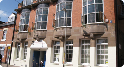
Lingering for a short while in Castle Gardens we can see this wonderful frontage of the ancient Leicester Castle with the spire of St Mary De Castro behind it. This walk is very close to the ancient parts of Leicester and is the subject of another of our treasure trails. The walls are made of Roman stonework and then the later brickwork was constructed on top. The building has had many facelifts over the years. Behind this wall is the 12th Century Great Hall, which is very rare because there are not very many of them left in England. www.leicester.gov.uk/EasySiteWeb/getresource.axd?AssetID…
47
Before we return to the main road (A47) we see King Richard III statue as we leave Castle Gardens.
48
Across the road we can see the apartments and the Brucciani factory. To the left of the picture there is a square brick construction with a circle inside it. There are two mermaids to be discovered made of terracotta, they were originally situated at the entrance to the old wholesale market in Halford Street which was busy during the 19th Century. The mermaids can be viewed when crossing back over the A47 to proceed east and go towards more ancient ruins.
49
The main road circulates around St Nicholas Circle and in the middle of St Nicholas Circle is the Holiday Inn, which is situated on part of the ancient Roman Forum. This corner of St Nicholas Circle was known as Applegate (now a renamed High Street further east). The name derives from the French ‘Appeler’ to call because there used to be an enormous West Gate into the Roman city here. When someone wanted to get through the gate they would shout loudly to gain attention for the gate to be opened for them.
This very busy road brings movement, wealth, distribution of goods and people into the heart of the town and cascades vehicles around Leicester, north, east and south. It is a very important entry to a modern city, always busy and always holding the history of thousands of years of human travel. It lies on ancient and roman remains.
50
This is Vaughan College with the Roman museum underneath. The college overlooks the foundations of the old Roman Baths. The river water was very close and the heating systems for the hot water are around these foundations. Further behind Vaughan College, on Bath Lane, the Victorians had public baths which were demolished in the 1960’s when St Margaret’s Baths were built – these in turn were demolished and Highcross Shopping Centre now stands on that site. These Roman baths illustrate how important the river was to the Romans and the easy access for transport because of it.
51
This is the so called Jewry Wall which was part of the Roman Baths and behind it we have the St Nicholas Church. It is argued that St Nicholas church is the oldest church in Leicester, it is believed to be Saxon in origin, which predates the 1000 year Norman St Mary De Castro Church. The Jewry wall itself is, if not the largest, one of the largest freestanding Roman walls in England. The fact that it still remains makes it a very significant treasure in Leicester.
52
Looking left here is St Nicholas Church.
53
Before we go to St Nicholas Church we look towards the site of the old Roman Forum with the Holiday Inn on the right hand side situated on part of the Roman Forum, there is aid to be a temple here. We see the cathedral tower, and St Nicholas Place before it leading into the medieval Applegate, to the far side, leading to the north is Highcross Street.
Highcross Street is one of the oldest sections of the city. Archaeologists have found items from the Iron Age under Highcross Street. It pre-dates the Romans, Saxons, Vikings and Normans. It is absolutely ancient. It now leads unceremoniously to the modern Highcross Shopping Centre and now with more renown, the site of the Blue Boar Inn, where Richard III is said to have stayed the night before his battle.
54
This is St Nicholas Walk, a pathway between Jewry Wall and ancient St Nicholas Church.
55 & 56
Here are the beautiful arches which show how extraordinarily big the wall was. They really wanted to fortify that wall! The enormous sized arches were doorways that led to the Roman Basilica. A basilica was an area for official offices, such as lawyers, in the Roman town.
57 & 58
The construction of the wall shows flat tile like bricks were used to build it. The stones are cemented in. The Roman’s were very clever with their cement. The Saxons did not use cement. This wall is one of the largest free standing roman walls left in Britain
59
This is another depiction of the intricacy of the arches and the use of arches within arches to give strength to the wall.
60
Here is St Nicholas church showing Norman and gothic architecture. Materials from the Jewry Wall and baths ended up in the tower of St Nicholas. If you look closely at the tower you will see Roman red tiling placed diagonally at the roof level.
61
We now proceed to the area enchantingly named Holy Bones.
62
There is an enormous amount of automotive repair works in this part of town. These small independent garages feature throughout this walk. The modern replacement of transport from walking, horse & cart, barge & boat and train.
63
Looking down towards Bath Lane along Welles Street to the west we see the Sikh Temple & museum.
64
And further down the remains of the Great Central Railway bridge – the stout grey and black wall.
65
Coming out of Holy Bones we see the old Victorian buildings, which face St Nicholas Place and St Nicholas Circle. These Victorian buildings would have replaced the medieval buildings situated here when they widened all this area in the mid 1800’s. They took away an immense amount of medieval buildings on what is now the High Street.
66
Here is our busy dual carriageway for the traffic to go round the city centre and there is the Highcross Shopping Centre car park. Road transport has completely transformed the whole area. This is truly a transport treasure trail. A short walk returns us to Victorian Leicester.
67
Turning left into Great Central Street we see some very interesting old buildings.
68
This building looks originally Victorian with modern additions to the top floor. The arches are very intriguing with unusual brickwork patterns on the walls.
69
We now find the Great Central Railway station itself. The big building is the old Parcels Office which had its own platforms for all the many goods and materials coming inand out of Leicester.
70
Before we get to the station there is this rather interesting Dutch looking building. It has the same architectural feature as the Parcels Offices of the Great central Railway.
71
We now get the view of how big the Great Central Railway station really was. It is close to the river and local industry.
Where we can see cars parked, above the signs, there was a turntable into which railway sidings brought the steam locomotives to turn and take them back, probably to London, or perhaps to the north. There were a number of station passenger buildings located on the platforms. This railways station was known as the ‘windy station’ because it was elevated to enable the railway to cross the River Soar to the north and again to the south. Its enormous width can be viewed on our Google map using satellite. The old railway lines now house many different light industry workshops and factories.
72
Looking at this abandoned land we see the site of the old Friars Brewery building, there until only recently when arsonists destroyed it. It was a much loved building and very ancient. The little street is the Friars Causeway which would have led to Highcross Street and St Peters Lane upon which Highcross Shopping Centre now stands. The Causeway follows the line of the Saxon roadway to access the river.
73
The fantastic architecture of the shopping centre is beautifully shown in this picture. This view should always be available to the city; it demonstrates the growing wealth of the early 21st Century in sharp contrast to the rapid expansion of the city in the late 19th and early 20th Centuries through its new Great Central railway. It is absolutely stunning and needs to be linked up because the shapes of the shopping centre and cinema match or reflect the top of the Great Central Railway roofing. This is an architectural marvel. It should be thoroughly treasured as a beautiful and stunning scene.
74
Here is the parcels gate still beautifully naming the Great Central Railway with tiling still intact. There are some lovely architectural curves all the way along the building. There was also a clock tower which has sadly now gone. This station was renowned for good time keeping.
75
Here is another entry point to the Great Central Railway. The gates look original and behind all the boarding we see cast iron gates with beautiful patterns on them. The men who now work inside are very interested in the history of the Great Central and its future. One owner said they have quite a few visitors from abroad, like the Americans who recently said that their grandfather used to work on the Great Central Railway. The men are very concerned about the increasing dilapidation of the buildings
76
The semi-opened gates ask us to peek inside. This website gives you photos of how the station looked in the past: http://www.gcrleicester.info/html/leicester_central1.html
77
Yet another automotive repair shop, but in such a grand location!
78
And further in the lovely glass roofing at the top are so characterful and so reminiscent of St Pancreas, imaging also the Highcross Shopping Centre – Showcase Cinema.
This is a view of the bottom of the station at the passenger entrance. Passengers then had to climb the stairs to get up to the platform, it being much higher up. If you look through the arch at the top of the orange iron gate you see the level of the railway lines and platforms – around 12 metres high.
79
This view is looking back towards the town. You can see that the top of the Great Central frontage has new (ugly) brick work built above it. It would have originally boasted the lovely Dutch arches above the railway frontage.
80
Looking on the other side of the road, there is EW Bryan’s Hosiery factory, for which manufacturing in Leicestershire has been famous. The building is still occupied.
81
Now we are going away from the Great Central Railway to All Saints Road.
82
Before we proceed under the Great Central Railway we look towards the old church on Highcross Street. Notice it is of gothic origin. It is All Saints Church opened once a year under Church Conservation Trust stewardship. They are working with a few local people who want to retain this historical building. It is truly part of this enormously historical part of the city, but sadly ignored.
The building next door to it just behind the traffic lights has wooden beams and may be medieval. It’s actually a much older building than it looks. Yet another ignored inheritance.
83
Proceeding under the Great Central Railway is very spectacular because above it are the old Victorian passenger platforms, still visible today.
84
On the other side of the bridge the many arches under the railway house a number of small businesses. Looking up towards the station on Jarvis Street we see the modern apartments once again to the side of the Victorian baths and built on the old dye works near Westbridge. The Great Central railway would have run right across the apartment site 100 years ago. The Great Central Generator House is on Alexander and Jarvis Streets, just a few meters away on the right. The rear entrance to the station is opposite this.
85
The arches towards Soar Lane, with their many car repair workshops.
86
Opposite the arches on Jarvis Street are some very characterful railway buildings at the end.
87
The buildings are being advertised as industrial units, sadly neglected but very attractive in design.
88 & 89
At the back of these buildings are workshops, once again still in use but as automotive repair shops. You can see the old cobbles underneath the tarmac. The 1904 map describes this area as Corporation Depot – we are not sure for what purpose. It may have been associated with the Swannington Railway because of its close proximity to Soar Lane Old Wharf.
90
The many automotive repair units are a vibrant part of this whole district, courtesy of Victorian Engineering and grandiose desires for modern transport options.
91 & 92
The railway runs north to Loughborough. B & Q now stands on part of its old route beside St Margarets Way. Moving out of the city it is still in use at North Station very close to Redhill Circle. Steam locomotives have been lovingly restored by volunteers dedicated to keeping the Great Central Railway alive. These majestic arches proudly stand as a reminder of the greatness of the railway and ask to be preserved.
93
Moving into Soar Lane we have done our whole route. We can see the Ship Inn on the left which is a modern building replacing an older terrace building. There is another factory at the end.
94
To the east is Sanvey Gate which runs where the old Roman walls once stood. This is why the route we have taken is so important. It picks up a part of the city which has been fundamental to its early wealth and development over the many centuries. Transport being absolutely central to that development.
95
Here again is proof of that wealth, road transport in the city supported by this great fleet of small industrial automotive units as we are inclined once again to go over the canal and straight into Rally Park.
Day Centre Local History Members hope you have enjoyed your visit:
Douglas, Steven, Simon, Stephen, David, Amarjit, Glen, Barry and Robin
Staff:
Vida Pearson, Head of Centre and Rebecca Zurek, Day Centre, Deputy Manager
Contact Us
We would be very pleased to receive your feedback and to know about your interest in our Trail route and all its history. Please email us:
[customcontact form=1]


